1. Introduction: Earth Has a New Guardian in Orbit
In a world increasingly battered by climate change, unpredictable natural disasters, and shifting terrains, a silent sentinel now orbits the Earth. It’s called NISAR—short for NASA-ISRO Synthetic Aperture Radar—and it represents one of the most ambitious and consequential Earth observation missions ever launched.
And India is at the heart of it.
Launched aboard the GSLV Mk II rocket from Sriharikota, India, NISAR isn’t just another satellite—it’s a global climate watchdog, a disaster response ally, and a triumph of international cooperation. With this mission, India has once again proved it is no longer just a participant in the global space race—it is a frontrunner.
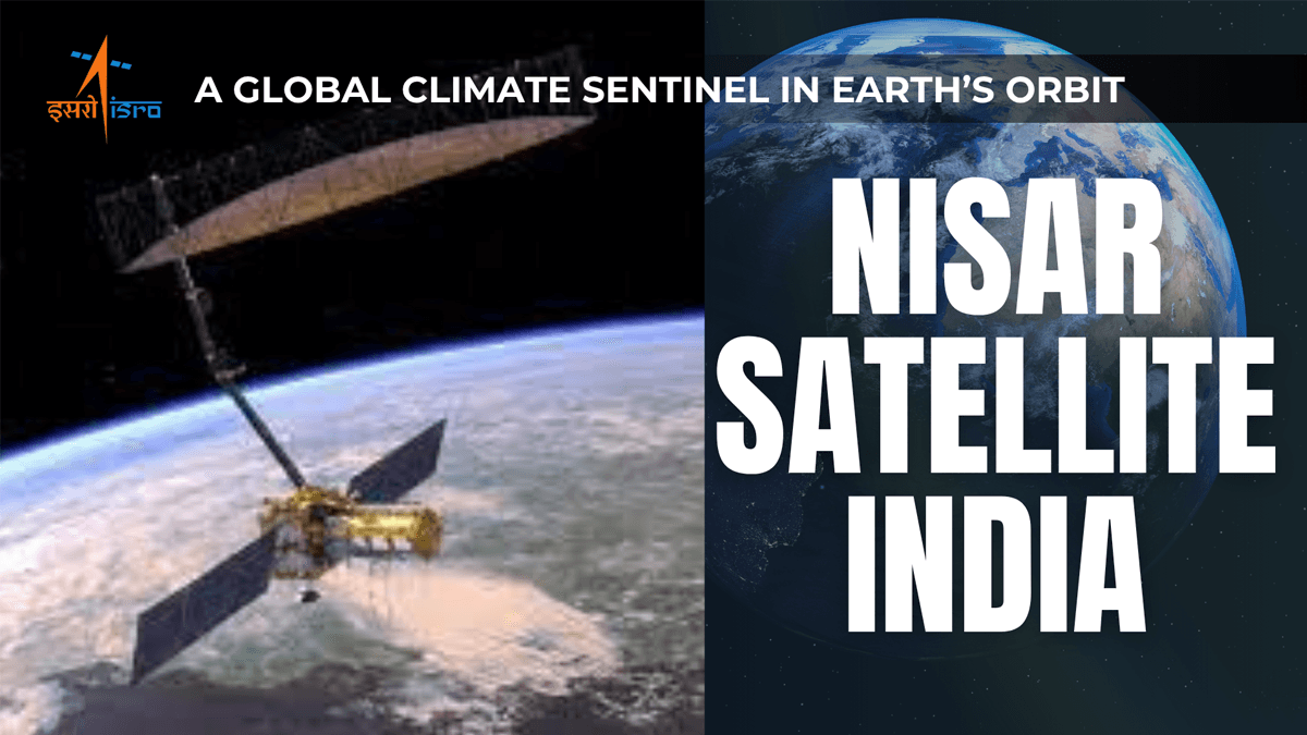
2. What Is NISAR?
NISAR is the world’s first dual-frequency synthetic aperture radar satellite, using both L-band (by NASA) and S-band (by ISRO) radar systems. While most satellites capture images using visible light, NISAR uses radar waves, which can penetrate clouds, smoke, vegetation, and even darkness—making it effective day or night, rain or shine.
It’s not a camera—it’s a precision radar tool that bounces waves off the Earth and records the tiniest changes in movement, terrain, or structure. From tectonic plate shifts to receding glaciers, from agricultural land usage to city expansion, NISAR will track it all.
3. The Journey: Over a Decade in the Making
The NISAR mission was first conceptualized over a decade ago. What began as a shared vision between NASA and ISRO has now culminated in a fully integrated satellite, jointly developed and tested, and now launched into orbit.
Cost: Over $1.5 Billion
Weight: Over 2,800 kg (nearly 3 tons)
Frequency: Scans Earth every 12 days
Operational Split: NASA manages global coverage; ISRO focuses on South Asia
Data Access: Completely free for governments, researchers, and students worldwide
4. Why It Matters: Climate, Crisis, and Command
a. Climate Monitoring
NISAR is designed to monitor ice sheet collapse in Antarctica, rising sea levels, glacier retreat in the Himalayas, and groundwater loss—factors that directly affect billions of people, especially in climate-vulnerable regions like South Asia.
b. Disaster Response
From earthquakes to floods, landslides to wildfires, NISAR can instantly assess damage and detect changes to the ground with centimeter-level accuracy. This means faster government responses, more targeted aid, and potentially saved lives.
c. Agriculture and Water
For India, where groundwater depletion, monsoon dependency, and agricultural planning are pressing issues, NISAR’s data will be a treasure trove. It can track crop cycles, monitor droughts, and even assess irrigation efficiency.
5. ISRO: From Launchpad to Strategic Space Leader
Gone are the days when ISRO was seen merely as a cost-effective satellite launcher for foreign payloads. Today, it stands shoulder-to-shoulder with the world’s top space agencies—not just as a facilitator but as a critical contributor and co-architect of high-impact global missions. The NISAR mission exemplifies this transformation. It’s not a NASA satellite launched by India; it is a jointly developed asset, with ISRO building and contributing the sophisticated S-band radar, the satellite bus, launch integration, and mission operations. India’s GSLV Mk II rocket—once viewed with cautious optimism—has now proven its mettle as a dependable heavy-lift launcher capable of handling complex and high-stakes payloads. As of July 2025, NISAR is fully operational in sun-synchronous orbit, already relaying critical radar data that will support early flood alerts in Assam and Bihar, aid climate tracking, and reinforce infrastructure monitoring.
6. Trusted by the World: ISRO’s Ascent to Global Relevance
NISAR is more than just a satellite—it’s a seal of trust in ISRO’s engineering, consistency, and global standing. With over 35 nations having launched their satellites via India, ISRO has positioned itself as a neutral and reliable space partner amidst growing geopolitical fragmentation. For the United States—home to NASA, the most powerful space agency on Earth—to entrust ISRO with the launch and critical hardware for a $1.5 billion flagship mission is nothing short of a strategic endorsement. This collaboration isn’t symbolic; it’s practical, cost-efficient, and deeply rooted in India’s technological maturity. As international partnerships become increasingly fraught with political complications, India emerges as a stabilizing force in space diplomacy. From the Chandrayaan and Mars Orbiter missions to co-leading Earth observation through NISAR, ISRO’s trajectory underscores how a once-underserved agency from the Global South is now indispensable to the future of space science and planetary resilience.
7. Beyond Science: A New Chapter in India-US Collaboration
This mission isn’t just a technological milestone—it’s a geopolitical signal.
At a time when global cooperation in space is often fractured by politics, NISAR stands as a beacon of science diplomacy. The United States and India have combined forces to create something that serves the entire planet. This isn’t just about Earth observation—this is about mutual trust, shared responsibility, and global leadership in tackling climate change and disaster resilience.
It also aligns with the broader India-US Strategic Partnership in science, defense, and technology.
8. The Data Revolution: Free, Open, and Global
What makes NISAR even more revolutionary is its open data policy.
The satellite will provide freely available data to all nations—rich or poor, developed or developing. Scientists in Africa, policy makers in South America, students in India—all will have equal access to data that was once the exclusive domain of military or space superpowers.
This alone makes NISAR a democratizing force in space technology.
9. Conclusion: The World Is Watching, and So Is NISAR
In a world hungry for solutions to the climate crisis, India has delivered—not just for itself but for the planet.
With NISAR now in orbit, India is not only scanning the Earth, but also carving a future where space is used for peace, preparedness, and prosperity. The mission may be about Earth science, but it marks India’s ascent into a new era of global space leadership.
The countdown is over. The world’s most advanced Earth-monitoring satellite is awake. And it’s watching—not with judgment, but with purpose.
10. FAQs: NISAR Satellite India Mission
2. When and where was the NISAR satellite launched?
NISAR was launched in July 2025 from Sriharikota, India, aboard ISRO’s GSLV Mk II rocket.
3. What makes NISAR different from other Earth observation satellites?
Unlike optical satellites, NISAR uses dual-frequency radar (L-band and S-band), allowing it to observe Earth’s surface day or night, even through clouds, smoke, or vegetation.
4. What kind of data will NISAR provide?
NISAR will track tectonic shifts, glacial retreat, sea-level rise, floods, landslides, crop patterns, groundwater levels, and more—every 12 days.
5. How does NISAR help during natural disasters?
NISAR can quickly assess ground movement and damage after earthquakes, floods, or landslides, enabling faster and more targeted disaster response.
6. What role did ISRO play in the NISAR mission?
ISRO contributed the S-band radar, spacecraft bus, satellite integration, and launch operations. It also manages regional data operations from India.
7. Who will use NISAR’s data?
NISAR’s data will be freely available to governments, scientists, researchers, and students worldwide to support climate monitoring and policy-making.
8. Why is this mission significant for India?
NISAR reinforces India’s status as a global space leader, enhances national disaster preparedness, and supports agriculture, water management, and infrastructure monitoring.
9. How does NISAR strengthen India-US relations?
The mission reflects deep scientific collaboration and mutual trust between India and the United States, aligning with their strategic partnership in space and defense.
10. Is NISAR part of a larger global effort?
Yes, NISAR represents a global effort to combat climate change through open data, advanced monitoring, and space-based cooperation for planetary resilience.